Norwegian County Road 63
TROLL ROAD – ENDALSNES – EFARNES – KRISTIANSUND – ATLANTIC ROAD – MOLDE – ALESUND
Mileage 350 km
Travel time: 5 hours 40 minutes
GPS (62.453659, 7.664493)
Ferry crossings:
Åfarnes - Sølsnes – 85 NOK (10.5 EUR)
Molde Vestnes- 136 NOK (17 EUR)
DIRECTIONS:
Option 1 Short, via the Åfarnes - Sølsnes ferry
Take road 64 to Åfarnes. Then take the ferry (20 minutes) to Sølsnes. Continue along km 64 to the junction with road E39. Turn right and follow the route to Batnfjordsora.
Option 2
At Åfarnes, turn right onto road 660. ( description included )
Attractions:
In Andalsnes:
The village of Åndalsnes is the terminus of the Rauma railway. On the eastern side of the valley is the 1,554-meter-high mountain Romdalshorn. Opposite is the Trolltindane (1,795-meter-high)
In Kristiansund
Kvernes Stave Church
On the island of Averøy there is a stunningly beautiful medieval wooden church.
One of Norway's most popular tourist destinations, the road is the heart of the Romsdall region.
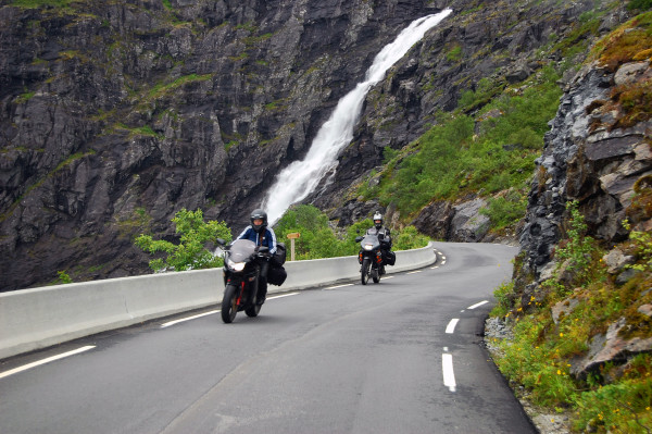
The section of road from Geirangerfjord to Åndalsnes is called the Troll Road.
At the edge of the cliff is an observation deck offering stunning views. The road was built in 1936. It currently features 11 steep switchbacks with a 12% elevation change.
Halfway down there is a bridge over the Stigfossen waterfalls (the height of the waterfall is 180 meters).
This road is not recommended for passenger vehicles towing trailers. It closes for the winter as early as mid-September.
The Troll Wall is a 1,000-meter vertical rock wall—the highest in Europe.
TROLLSTIGEN- THE TROLL`S ROAD
- Åndalsnes-Valldal: 20 km km (20 min)
- Valldal-Valldal: 35 km km (35 min)
Each bend of this road has its own name.
The road is narrow with a 9% slope. There are pockets for passing and overtaking.
The maximum permitted length of vehicles is 12.4 meters.
The road is closed during the winter months. Currently, it is visited by over 600,000 travelers and tourists between June and October/November.
The road's highest point, 852 m, is located on the municipal border between Rauma and Norddal. From the north, Trollstigen is the gateway to the Trollstigen Geirangerfjord region. The road typically opens in late May/June and closes with the first snowfall, usually in late October/November.
Trollstigen, with its waterfall, Stigfossen, is surrounded by mighty mountains, reaching an impressive 1,600 m. Stigfossen waterfall flows down the mountainside into the lush Isterdalen valley.
To the west you can see the mountains Bispen (1462 m), Kongen (1614 m) and Dronninga (1544 m). To the east, the rocky Stigbottshornet (1583 m) and Storgrovfjellet (1629 m).
The old pack trail has been restored and is a favourite and breathtaking walking route for those wishing to climb Trollstigen on foot.
History.
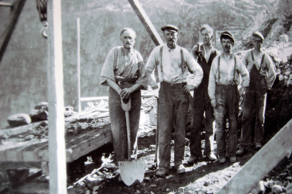
The road was opened on July 31, 1936, by King Haakon VII of Norway, who named the road Trollstigvegen (the section between Øvstestølen and Bøsetra) at the opening ceremony. This was a long-awaited gift to the residents of Valldal. For several hundred years (1533–1875), the Romsdals Market (in March) was an annual occasion for trade and social life in the region, and thus mountain access was important for farmers who bought and sold horses and cattle. Farmers from both sides of the mountain worked hard and long without pay to build the road, and in 1891 a country road, known as a "pack trail," was completed.
In 1905, the road was accessible on horseback. It was completed in 1913, but on its steepest stretch, it remained little more than a pack trail. Work on upgrading the Valldalen-Romsdalen road began in October 1916 on the Valldal side, with the construction of new bridges over the Valldøla River near Gudbrandsjuvet (1919), at Hoel (1921), and Krike (1926-27). Work began on the Romsdal side in 1928, and a few years later the impressive road was opened.
HUNDERFOSSEN Troll Park
http://www.hunderfossen.no/English/
(+47) 61 27 55 30
Fax : (+47) 61 27 55 55
Address: N - 2625 FÅBERG, Norway
Hunderfossen Family Park
2625 Faberg